|
|
|
About Grant
County |
|
Grant County, Washington
From Wikipedia, the free
encyclopedia - The data below reflects data
obtained on July 2nd 2013 |
Grant County is a
county located in the U.S. state of Washington.
As of the 2010 census, the population was
89,120. The county seat is Ephrata and the
largest city is Moses Lake. The county was named
after U.S. President Ulysses S. Grant.
Grant County was formed out of
Douglas County on February 24, 1909.
History
Native American cultures in the
area included the Interior Salish, Wenatchi,
Okanagan. The first white settlers began to
arrive in the mid-to-late-19th century,
primarily with the goal of raising livestock.
One government official described the area in
1879 as, "…a desolation where even the most
hopeful can find nothing in its future prospects
to cheer...".
When railroads arrived they also
brought new settlers, and the economy began a
shift from ranching to dryland farming. This
transition required the people to have ready
access to water, and irrigation became a
necessity. The first large-scale irrigation
attempts began in 1898, but it would be years
before real success.
With the influx of dryland
farming, the county soon boasted access to three
major railway systems; the Great Northern
Railway, Northern Pacific Railroad and the
Chicago, Milwaukee & St. Paul Railroad. In
addition, the Columbia River in this area was
navigable. This allowed crops to be transported
out of the area easily. Towns like Wilson's
Creek, Quincy and Ephrata began to thrive.
The Washington State Legislature
officially created Grant County February 24,
1909, and named after President Ulysses S.
Grant. The county seat was located in Ephrata.
The population in the county at the time was
only about 8700 people.
The Columbia Basin Reclamation
Project, which began as a group of businessmen
from Ephrata began looking for ways to make the
area more viable. One idea was to dam the
Columbia River at Grand Coulee. Although the
idea of the Grand Coulee Dam would not be
approved until 1933 and still not implemented
until 1939, the project would fundamentally
change the region forever.
According to the U.S. Census
Bureau, the county has a total area of 2,791
square miles (7,228.7 km2), of which 2,681
square miles (6,943.8 km2) is land and 110
square miles (284.9 km2) (3.95%) is water.
|
|
Grant
County, Washington |
|
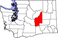
Location within state of
Washington |
|
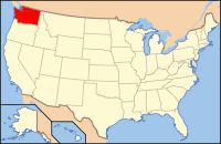
Washington location in the
U.S. |
|
Founded: February 24, 1909
|
|
Seat: Ephrata |
|
Largest city: Moses Lake
|
|
Area:
Total: 2,791 sq mi (7,229 km²)
Land: 2,681 sq mi (6,944 km²)
Water: 110 sq mi (285 km²), 3.95%
|
|
Population Estimate.
(2011): 91,265
Density: 33/sq mi (12.8/km²)
|
|
Time zone Pacific: UTC-8/-7 |
|
|
Geography
According to the U.S. Census
Bureau, the county has a total area of 2,791
square miles (7,228.7 km2), of which 2,681
square miles (6,943.8 km2) is land and 110
square miles (284.9 km2) (3.95%) is water.
Geographic Features
-
Columbia River
-
Moses Lake
-
Potholes Reservoir
-
Grand Coulee
Major Highways
-
Interstate 90
-
U.S. Route 2
-
State Route 17
-
State Route 28
Adjacent counties
-
Douglas County, Washington -
north
-
Okanogan County, Washington -
northeast
-
Adams County, Washington -
east
-
Lincoln County, Washington -
east
-
Franklin County, Washington -
southeast
-
Benton County, Washington -
south
-
Yakima County, Washington -
southwest
-
Kittitas County, Washington -
west
National protected areas
-
Columbia National Wildlife
Refuge (part)
-
Hanford Reach National
Monument (part)
-
Lake Roosevelt National
Recreation Area (part)
-
Saddle Mountain National
Wildlife Refuge (part)
Demographics
|
At the 2000 census[6], there were
74,698 people, 25,204 households and 18,676
families residing in the county. The population
density was 28 per square mile (11/km²). There
were 29,081 housing units at an average density
of 11 per square mile (4/km²). The racial makeup
of the county was 76.54% White, 0.99% Black or
African American, 1.16% Native American, 0.87%
Asian, 0.07% Pacific Islander, 17.36% from other
races, and 3.01% from two or more races. 30.09%
of the population were Hispanic or Latino of any
race. 15.1% were of German, 8.1% United States
or American, 8.0% English and 5.4% Irish
ancestry according to Census 2000. 72.0% spoke
English and 25.3% Spanish as their first
language.
There were 25,204 households of
which 39.90% had children under the age of 18
living with them, 59.30% were married couples
living together, 9.80% had a female householder
with no husband present, and 25.90% were
non-families. 21.20% of all households were made
up of individuals and 8.90% had someone living
alone who was 65 years of age or older. The
average household size was 2.92 and the average
family size was 3.38.
32.00% of the population were
under the age of 18, 9.80% from 18 to 24, 27.00%
from 25 to 44, 19.70% from 45 to 64, and 11.50%
who were 65 years of age or older. The median
age was 31 years. For every 100 females there
were 104.50 males. For every 100 females age 18
and over, there were 103.40 males.
The median household income
$35,276, and the median family income was
$38,938. Males had a median income of $32,414
versus $24,310 for females. The per capita
income for the county was $15,037. About 13.10%
of families and 17.40% of the population were
below the poverty line, including 22.30% of
those under age 18 and 9.40% of those age 65 or
over.
Census-recognized Communities
|
|
Historical Populations |
|
Census
|
Pop. |
%± |
|
1910 |
8,698 |
— |
|
1920 |
7,771 |
-10.7% |
|
1930 |
5,666 |
-27.1% |
|
1940 |
14,668 |
158.9% |
|
1950 |
24,346 |
66.0% |
|
1960 |
46,477 |
90.9% |
|
1970 |
41,881 |
-9.9% |
|
1980 |
48,522 |
15.9% |
|
1990 |
54,758 |
12.9% |
|
2000 |
74,698 |
36.4% |
|
2010 |
89,120 |
19.3% |
|
Est. 2011 |
91,265 |
2.4% |
|
|
Other Communities
-
Adco
-
Adrian
-
Beverly
-
Lakeview Park
-
Mae
-
Ruff
-
Schawana
-
Stratford
-
Trinidad
-
Wheeler
-
Winchester
References
^ United States Census Bureau. "2010 Census
Data". United States Census Bureau. Retrieved 6
May 2012.
^ "Milestones for Washington
State History — Part 3: 1901 to 1950".
HistoryLink.org. March 6, 2003.
^
http://historylink.org/index.cfm?DisplayPage=output.cfm&file_id=8010
^
http://greatgrantcounty.com/index.php?option=com_content&task=view&id=12&Itemid=26
^
http://ncwportal.com/community/north_central_washington_in_the_1900s#grant
^ "American FactFinder". United
States Census Bureau. Retrieved 2008-01-31.
|
|
|
|